Lake District Day 2

Monday April 23


Monday! And the view out our window is nothing but fell.
At breakfast we figure out the plan. We want to do Scafell Pike - the tallest in England! - and then figure out a different path back to New Dungeon Ghyll.


Traditional English breakfast is way too much food. Black (it’s really blood - though Agnes is reluctant to tell me that) pudding, tomatoes, beans, mushrooms, sausage, bacon, eggs, fried bread (kinda gross), toast, and delicious jam. We get our sausage to go, and the lady looks at the map with us. Should be fine, but a LONG walk she says. Fine by us.


It’s colder today, windier, but not raining for now. We set out to climb up the opposite side of the valley. Clear path, quite steep, up along a creek. Two guys coming down from Scafell seem bundled up, and a bit judgy. It’s -4C up there today, they tell us. Then, in response to our apparent surprise: but we were prepared - we’d checked the weather forecast. Well, thanks Mr. Gold Earring.


As we continue, another guy comes running along in jeans and Blundstones. He stops to tell us it’s not too far now. Was he cute? Hard to tell under his hat and ski mask.


Once again, into the cloud. It’s thick and very cold. Once again, the path forks unexpectedly. Is it going around, or do we just go up? Once again, I make the wrong call - I’m just way too devoted to following a clear path. Agnes, logically, knows we need to go up, but follows me anyways - we’ll just see where this goes. Some people coming down set us straight. Just follow the cairns, like Mr. Judgy Gold Earring said. It’s a rock field, and they are the only thing you can see in the cloud. It’s not a bad climb, but a bit of a scramble.

There are a few people at the top - a crowd, compared to what we’ve seen before - including a couple speaking Polish. Agnes says hello, and we start chatting. Both wearing buffs, her with short hair, him with long dreads and a straggly goatee. They work in the food industry in Manchester and are making the most of their holiday. They take a picture of us by the plaque - the National Trust land was given after WWI - and give us tangerines. After a short chat, they head off down the mountain.


We follow a bit later, after another look at the map. Going down is much less fun. It’s scrambly and windy and impossible to see far. At one point, I can’t see the ground more than a metre or so ahead. It looks like we just drop off a cliff, into the cloud abyss. I’m totally paralyzed. Agnes calmly tells me to just keep moving, keep going. I shuffle forward - this is not cool - but finally, the ground re-appears.
Entering the Cloud


We reach a fork. We know we want to head down into a valley by a river. I see where it SHOULD turn off, but no clear path. Another path goes straight ahead. We opt to follow the cairns. Two girls appear out of the fog - confused, because they’re heading down when they want to get to the peak. For once, we can give directions - and be a bit judgy, since they have no map.


We slog on across a boulder field. Cairns are the only markers, and thank god they’re there. The wind is horizontal, freezing cold. Finally, we get onto a path, start to come out of the cloud. There are big patches of snow around still.


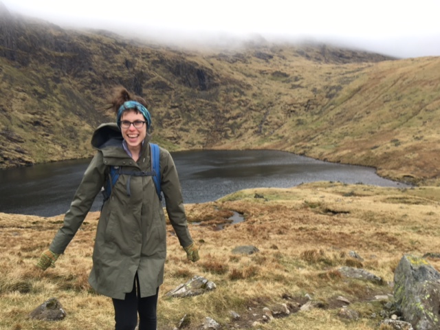
And then we see a lake. What the hell is that?


We are definitely not by the river we hoped for. So where the heck are we?


Agnes shows, once again, her innate skill at translating between map and reality. (Does a PhD in scientific models help?) That tarn is a clear landmark, she says. And the only thing that makes sense is Sparkling Tarn. But how the hell did we get there? I say. We were heading east, sure, and we did cross a rock field, fine, and that does look like we could have gone to Great End … but the trail ends there. And clearly we were on a trail!


Agnes adds:
I point out parallels between map-and-compass navigation and some problems in the philosophy of science. It’s all epistemology, really: how do we know what we think we know? For instance, there’s the underdetermination of theory by evidence, the fact that multiple theories are compatible with a given set of observations. I had a theory about where we were on the map, with evidence to back it up, and so did Julia. Both theories explain some phenomena -- the position of the tarn for my theory, the fact that we were on a trail the whole time on Julia’s. Both also fail to explain others -- we shouldn’t have been on a trail the whole time, on my theory, but we were; the tarn shouldn’t have been where it was for Julia. So how do we choose between them?


We walked to a fork, and waited for a couple to get close. The guy checked his GPS, and pointed out exactly where we were on the map. Exactly where Agnes expected. Who cares that the map didn’t show our path? That lake did not lie.


We were actually back where we’d been with Tim the day before, and we set out back towards the New Dungeon valley … now very cold, very hungry, and very sad to be heading back into the cloud.


Once again, we got a bit confused at a crossroads. I was determined to use the compass properly. Straight ahead!
Soon enough, we were out of the cloud. There was Angle Tarn. Exactly where we’d been yesterday. But we didn’t really want to just retread familiar ground, right back to the hotel. Where’s the fun in that?


We finally plunked down to have lunch (sausages!! Never tasted better!) and another look at the map.


There was another little path going away from Angle Tarn, across the hills. It eventually hit the Cumbrian Way, and went down into the valley along a different route. Why not try that?
As soon as we got cold (didn’t take long) we packed up lunch, and headed back along the path. There was an older gent in a blue raincoat with a scruffy little terrier. I asked him if he was alright (genuinely, not just a greeting) and he said no, not really. He’d had heart and lung operations not so long ago, and he really wasn’t feeling great. We chatted a bit, but broke it off fairly soon. We had to keep moving. (This prompted a conversation about the right amount of chat with strangers you meet - it’s a balance. You want a bit of info, but you don’t really want to get into a long committed conversation - turns out Agnes and I have about the same limits).


Off onto the grassy hillside. Right away, the path was faint. Barely pathy. We took a compass bearing, and followed it. The weather was getting wild. It started to rain - not straight down, but directly sideways. The right side of my face was getting pressure washed. My glasses were so wet I couldn’t really see. If you lost your balance, the wind would push you the rest of the way. We were up on a kind of ridge, trudging along with no real path, just following the compass. Agnes’s pants were soaked through, her boots were killing her.


We were both cold and soaked, and this added a sense of urgency. If we didn’t keep moving, we’d freeze. If we couldn’t find our way back, we’d be in real trouble. For a little bit, we jogged down the narrow path -- in part to stay warm, in part because it was just so much FUN! We’d given up keeping our feet dry, and just sloshed right through the middle of puddles. Also fun. The whole time we were giggling like we were high. No twining, just a little clahhhhhhty bit! It could have been miserable. But it was just the opposite.
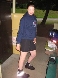
Not how we looked at this point.
But kinda how we felt!


Off in the distance, I saw another line cutting across our path. The Cumbrian Way? It had to be. Finally we got there - and it was a path! The path down!


It was a treacherous descent - down is SO much harder than up - the path was a small waterfall, full of switchbacks.


Finally, familiar ground - the Cumbrian Way down in the valley. Only about an hour to go!
So we started singing. Yelling, really, into the wind and rain. It started with All Star. Sugar Ray - what was that song?? - Just Wanna Fly. Lion King. I’m Blue, Barbie Girl. Trying to remember that Third Eye Blind song … Ace of Base. Hanson’s classic Mmmmbop, then Where’s the Love. Chilli Peppers, Sublime’s Santeria (though I was pretty rough on the words for that one - Agnes was on point).


Then sheepfolds. The Old Dungeon Ghyll hotel. Past the Stickle Barn. And we made it! Sopping wet, boots covered in sheep shit. Tracking it all into the posh entrance of the New Dungeon Ghyll. Room 2 tonight, on the ground floor - once again cute twin beds.
One problem: the drying room was outside - just a shed with a heater and a lot of hangers. Not much help for our boots, but whatever. Showers, but still not warm.


We opted for the Walker’s bar, rather than the restaurant for dinner - more our speed. Beer, burger for Agnes, meat pie for me. Okay food, not amazing. Biscuits and tea and TV again - this time a hit of hard news. A press conference with Ralph Goodale - some car drove into pedestrians in Toronto, killed 10 people. Unclear if it’s terrorism. Too much reality.
Then, trivia competition between Cambridge and Oxford teams (Cam won!!) and some strange BBC 4 drama involving virtual reality called ‘Kiss Me First’ (who is kissing whom? We never figured that out). I fell asleep before it was over.


Total walking - 10 AM to 6ish. A solid 8.5 hours.
x

Lake District Day 1

Sunday April 22 

THIS IS HOW YOU VACATION. 

Start by making a whole whack of sandwiches. We form an assembly line - mayo, hot mustard, ham, salami, cheese … PB & honey and bananas for breakfast. Already everything is easy. We know how to do this, and I love the efficiency of our packing. Carrots, hummus, apples, granola bars, nuts, chocolate and jelly babies - already busted into last night, because the texture is just so good!

It’s still sunny and balmy, well over 15 degrees. Hit the road, to the NORTH, as the signs keep telling us. So many roundabouts. I’m driving, because now I have practice (and sleep) it’s not so bad. 

Then the roads get narrow. Seriously narrow, and twisty. Cyclists on one side, ancient stone walls (Agnes calls them ‘moors’ - is that right?) and whizzing cars just beside me. I’m paranoid about the right side of the car - I misjudged where that curb was - and Agnes is stressed for me. But at the same time the driving gets painful, the landscape starts to change. Lakes. Mist. Mountains! I can barely look, I’m so fixated on the road, but Agnes is squealing. She wasn’t excited until now - how different could it be? But it’s DIFFERENT. This is the Lake District, for real. We listen to Kamasi Washington’s Fists of Fury, an epic soundtrack for our entrance. 


Finally, we make it - New Dungeon Ghyll Hotel, a charming old stone house in the countryside, surrounded by giant hills. There’s a race or some event on - officials, cars, many muddy cyclists. I gratefully park, and we take stock. It’s about 2 pm. Our goal is to get over to the Wasdale Head Inn tonight, where we’re booked in. That means hiking across the peaks, into another valley. It’ll take at least 6 hours, we figure (based on Coach Mike’s helpful tips). We can make it, but barely. 

We ask the guy at the bar. He’s very helpful, especially considering we didn’t buy any food there - just gobbled our own sandwiches. If this were a horror movie, this is the harbinger moment: ‘go that way, at your peril’. He says: if you don’t make it to Angle Tarn in two hours, you MUST come back. One of his front teeth is black. 

We set out - still sunny and warm. The path goes along the Cumbrian Way, a major walking route. It’s clearly marked, through sheepfolds, along the valley, up along a little creek. We can’t stop marvelling at everything. The loose-stone fences, stretching high up into the hills. The lack of trees. The clouds racing across craggy peaks. The variety of sheep gate technology, complete with dog gates - and signs with a picture of a bloody lamb - keep your dog on a lead, or else. 

There’s a fork in the path, with a rare sign post. The Cumbrian way goes right, up to Stake Pass. Our path leads left - towards Esk Hause (whatever that is). So we begin to climb, up out of the valley. Agnes soon ‘de-kits’ - British for strips down to her shorts and t-shirt. I’m still in my rain jacket, against the wind. 


The list of British-isms is growing.
Faff = futzing around, especially common before/after rowing
Outings = going out for a row
Kit = your gear
Y’alright? = most confusing way to say ‘how’s it going?’ Still no idea how to properly answer.
[Added later:
Chilled = a song is ‘chilled’ not ‘chill’
Sorted = amazing expression. Sorted out, figured out, taken care of. As in: dinner’s sorted. Or in King’s Cross station: see it, say it, sorted. Way better than See something, say something]
Probably not the first selfie that day
It is a steep climb, and a long one. But the path is good - rocks, laid like stairs. At regular intervals there are neat stone-lined sluice-ways, to drain the path. We abandon our walking poles (another loan from Mike) - I can barely think about where to place my feet; I’m way too dumb to think about a pole as well. The view just gets better behind us. The whole Shire spread out below us, adventure ahead.
At the top, a new sight. A Tarn. It looks like a small lake, sort of a mountain pond. Because there are no trees or anything, you can see the whole shape. We’ve made our two-hour marker with a little room to spare - no going back now. Time to take a compass bearing, according to the harbinger at the bar. So I do. We need to head roughly north east, across the hills towards the next Wasdale valley.


The path seems good ... But we’re heading up into the cloud. It’s getting cold. The dull grass is beaded wet. Coats on, hoods up. Then - kind of suddenly, the path is no longer obvious. There seem to be at least three paths, near a random stone structure. Which way? I check the compass, and figure we head off this way - but I’m not 100% sure. It’s not quite the right direction, but the path looks okay.
IT'S A TARN!

It’s cold - I really wish I brought my mittens. We pause again, for Agnes to zip her pant legs back on, and then - a dog! Black with a bit of white around the muzzle. Then a man appears out of the cloud. Charlie-bee! He calls the dog. Turns out, it’s his friend’s dog, but he takes him out for walks. I ask where he’s been - Scafell Pike. That is NOT where we want to go today. But somehow, that’s where we’re headed. So much for my compass bearing.


Tim - that’s the man’s name - orders us to come with him. He’s got a green rain coat, dark hair in a little pony tail. Super friendly, VERY fast walker. He’s not judging us, but he makes it clear we were in danger. People get lost up here, he says: break things, fall off ledges. There’s a mountain rescue squad of volunteers - he can’t climb, so he’s not one of them.


He offers some new vocab for us, real Cumbrian words:
Twine = whine.
Clarty (PRON: Clahhhhhty) = boggy, wet ground
(We will use these words a LOT over the next few days.)


He answers a few of our questions: what’s a Ghyll? A little creek. What’s a fell? A mountain.
He does not tell us who laid the paths or who build the fences up the hills (and are they called moors?) but then, we didn’t ask.


Soon, we’re out of the cloud. The sun is still out, on the far hills. And we’re heading down.  Tim and Charlie head off into another valley, and we’re on our own, walking by Sparkling Tarn.


Another landmark from the guy at the bar - ‘the coffin’. It’s a wooden box, just the size for a person - inside, a stretcher. Grim.

The sun is getting low, we’re getting tired … but now I think we can see our destination. Way off down the valley, there are a few buildings, near a big lake: Wast Water, and hopefully, Wasdale Head Inn.


We start the long descent. There’s a level full of slugs - shiny, black, everywhere.
And then we’re into a long series of sheep folds. We bah and they bah back. There are lambs! Lots of them, plus some pregnant sheep. And once again, we have many questions:


Are all of these girl-sheep?
Where do they go to sleep?
Why are all the newborn lambs black?
Do they turn colour as they get older?


Just as it starts to rain, we get to the back of the Wasdale Head (it is the Wasdale Head!!). It’s perfect, a quaint old inn - the only one here. Inside, the walls are covered in old photographs of walkers and climbers. Men scaling peaks in bowler hats. We’re in room 8, perfect Holiday Inn set up of twin beds.


We eat at the pub in the back. Sunday roast for Agnes, brisket stew for me, and stout for both of us. The stew looks a bit like dog food, but it’s delicious - the better of the two choices, we both agree.
After sharing photos and instagramming - biscuits and tea in our room, and TV. Of course, Lord of the Rings would be on. Eventually, sleep.


Total walking: 2-7ish. A good 5 hours.

Cycling northern Wisconsin and Michigan's Upper Peninsula (10 days, 1050 km)


I can't believe that it's now been ten years since I completed my first cycle tour from Vancouver to Halifax. And five years since I posted about any tour at all (a two-week trip from Frankfurt to Barcelona)! So, I thought I'd update this little blog, because I've just completed another lovely tour through Wisconsin and Michigan's Upper Peninsula. Kris Evans and I had a very wonderful, adventuresome but relaxing ten days of cycling (followed by four days kayaking in the Apostle Islands!).


This trip was less about covering distance and more about meeting people, relaxing, and taking in the natural beauty that the UP and northern Wisconsin have to offer. Yet we still averaged over 70 miles a day (not taking into account the bit of cycling we did on our off day)! Not bad, if you ask me.

On our first day of riding, I said to Kris, "You know what would make me happy? If we could go swimming and have a campfire everyday." He laughed — how demanding! But I'm happy to report that we did go swimming every day, and had a fire each night we camped, except one. 

Some highlights:

1. Beating the rain

DAY 2: Cecil, WI to Fox County Park, MI, 88 miles 

Our goal on this day was to stay at Fox County Park, our first time hitting the shores of Lake Michigan. But when we stopped for water at a gas station about 5 miles from our destination, it started to seriously cloud over. Should we keep going to the park, and risk having to set up in the rain, or stay here? We decided to press on, with Kris leading the way and me in his draft. As we were cycling, we started to feel droplets. The urgency propelled us forward. We arrived at a beautiful, empty campground, and set up our tent as quickly as we could. The moment the tent was up, it started to pour, and we jumped inside. We didn't even have time to get our stuff off the bikes and put it in the tent's vestibules, but we were so relieved to be inside and dry(ish)!


What happened next was magical: the rain let up for just enough time to enable us to go swimming and cook dinner (due to wet wood, this was the one camping night we were unable to build a fire). Lake Michigan was really cold (but, as we would soon find out, not nearly as icy as Superior!), but the swim was invigorating. It started to rain again as soon as we were back in the tent and ready for bed. It's always nice when the rain falls only when you're in the tent :)

The next morning was sunny!


2. Pictured Rocks National Lakeshore

DAY 4: Limestone, MI to 12 Mile Beach Campground, MI, 57 miles

We took a day and a half off to explore Pictured Rocks National Lakeshore. Our original plan was to spend two nights at 12 Mile Beach Campground, right on the shores of Lake Superior. We'd heard it was beautiful, and we'd heard right:


But there was also a major problem: we arrived in the peak of bug season, and we were swarmed by black flies, which were especially keen on biting ankles. We were in paradise, but even walking along the beach was painful. Our only reprieve was to jump into Lake Superior. As much as I love jumping into the water, and even though it was really hot, I almost couldn't do it. It was so cold that even standing in it up to my ankles for more than 10 seconds was unbearable. But Kris got in with faux joy, and even stayed in for a ridiculous amount of time. So, after multiple failed attempts, I did it, too! The temperature must've been sub-50 F, i.e. sub-10 C, i.e. ICY.


We spent the remainder of our first half-day off playing cards and drinking box wine in our tiny, two-person tent, the only place other than the frigid waters of the lake that we could get away from those nasty little creatures.

DAY 5: 12 Mile Beach Campground to Little Beaver Lake Campground, 19 miles

Rather than staying two nights at 12 Mile Campground, as we'd originally intended, we decided to head to nearby Little Beaver Lake Campground for our day off. Our hope was that the bug situation would be better there. Plus, it was right on the hiking trail to see the famed Pictured Rocks, which is what we wanted to see on our day off.

The ride to Little Beaver Lake was lovely. Kris and I marvelled at how fun it was to just ride 20 miles on a day off: the fact that we didn't have any real distance to cover that day made the ride very casual and enjoyable.


We descended a fairly steep hill down a somewhat precarious gravel road


into the tiny Little Beaver Lake Campground. We found a lovely site with access to the lake. And we were happy to discover that there were no black flies there!


After pitching our tent, we set off for our hike. But as soon as we entered the thick woods, we were swarmed by dense clouds of mosquitos. And (because we kept forgetting to buy some) we didn't even have any bug spray!

Kris was admirably calm; I panicked. My hiking pants protected my legs, but my top half was exposed, since I was wearing only a quick-dry t-shirt. In a particularly distraught moment, I slipped and fell pretty hard on the trail, scraping my elbow and bruising my butt. Fortunately, Kris, being the kind-hearted soul he is, offered me his bug-proof long sleeve and mosquito head net. I was now safe!

Shortly into our hike, it started to rain. Except for one moment when I shrieked (and Kris laughed at me) because a clap of thunder and lightning struck very close to us, we were unperturbed. And the pictured rocks (which is how I referred to all of the rocks there!) were stunning:


It was still raining when we got back from our hike, and yet we managed build a fire — with wet wood, no less! And by "we" I mean Kris, with me as his helper (Just keep feeding the fire with the small stuff, he told me; I dutifully complied, and it worked!). We cooked over this fire, and then went swimming — all in the rain!


The thing I loved best about this day was that we made it work: we had so much fun, in spite of suboptimal conditions. These are the days that remind us what a great thing it is to be cycle touring. There's something gratifying about not only persevering, but also enjoying ourselves, even without the comforts of day-to-day life or "ordinary" vacation.

3. The kindness of strangers

DAY 8: Silver Lake to Eagle River, 78 miles

We knew it was going to rain, probably by late afternoon, when we set off from Silver Lake. After three or so hours of cycling, Kris was ready to stop for lunch, but I suggested we put it off to see if we could beat the weather. Kris was game, so we cracked on, stopping only for quick snacks by the side of the road.


This was such a fun day of riding: we both seemed to have boundless energy and, once we got going, were determined to just keep at it straight to Eagle River. It's so much fun when that happens, and it doesn't happen every day! Although it was cloudy, the day was perfect for riding, and we stumbled upon some great little gems, such as a long, paved bike path, and the old abandoned town of Alpha, WI.


We were quite pleased with ourselves when we pulled up to the grocery store in Eagle River around 4 p.m., and it still hadn't rained. But just as we were about to go in, the storm began. We consulted our phones, and it looked like it was going to last at least a few hours. We'd made it, but we hadn't: we still needed to find a place to camp, and then set up, make dinner, etc. But just as we were deciding what we should do next, a couple approached us with their groceries. Which way were were heading, they asked, and would we like to stay with them for the night? Kris and I looked at one another in pretend consultation, but really, we were both just thinking YES THAT WOULD BE AMAZING!

Barb and Steve took us and our bikes to their home overlooking Anvil Lake. We had the whole basement, which, unlike your typical basement, had a whole wall of windows overlooking the lake. We went for a swim, had showers, and then had beers and sausages and beans with Barb and Steve. Barb and Steve were wonderful hosts who shared our passion for cycling and discovering new and interesting places.


The next morning, they made us a mega breakfast: coffee, eggs, bacon, and pancakes! They directed us to Military Road to start our cycling for the day, and it was hands-down the best road of the trip. Beautiful, remote, and full of twists and turns and the fun kind of hills, those you can just fly over. Kris said to me, "A few days ago [cycling to Eagle River], I saw determined Agnes cycling. Now I'm seeing kid-in-a-candy store Agnes." And he was right! I couldn't help but smile from ear to ear on that amazing road!


There are so many more things I could write about here: our stay in lovely Marquette, MI with Warm Showers hosts Giselle and Joe; our sweet campsite in Limestone, MI and the great general store there, with its friendly owners and mind-blowing pizza and cinnamon roles; our final, determined push back to Stevens Point. And then there were the lowlights, so to speak, which are hard at the time, but make this not just a vacation, but an adventure: the headwind on the road to Limestone, the sleepless nights in our sometimes-too-hot-and-squishy two-person tent, the chaffing and various other aches and pains. But man, do I have fond memories of this trip! I can't wait till the next one!